Wednesday, September 14, 2011

#19 - Lava Canyon

Before
After

Kablamo!


Date: 8/13/11
Time: 3 hours
Distance: 6 miles
Difficulty: Moderately Strenuous
Stars: 5


Mt. St. Helens erupted on May 18, 1980. The column from the eruption rose over 80,000 feet into the atmosphere and ash was deposited into 11 different states. The elevation of Mt. St. Helens was 9,677 feet before it erupted. It now stands at 8,363 feet. The eruption instantly melted ice, snow, and entire glaciers that previously sat atop the volcano, and created lahars, volcanic mudflow, that traveled at 10-25 mph down the volcano and destroyed just about everything in it's path.

3,500 years ago, an eruption from Mt. St. Helens filled a deep forested valley with volcanic rock. A river carved dramatic cliffs and waterfalls through this rock, creating a beautiful canyon. Over time, mudflow filled the canyon, however, and forest grew back over the mud. But the lahars from the 1980 eruption blasted through this forest, removing the trees and softer mud and exposing, for the first time in thousands of years, Lava Canyon.


The path of the lahar


The most amazing part of the history of Lava Canyon, in my mind, is the power created by the eruption. And the most amazing part of the hike was the sense of that power you could feel just from your surroundings.


Evidence of the destruction left by the lahar


The hike started high, and we travel down into the canyon. Above, the evidence of the lahar is very apparent, with debris from the mudflow still present. The trail is very easy up top. There are boardwalks constructed, signs that explain what happened in the canyon during the eruption, and even some paved paths to make an easy, 1 mile loop for anyone to enjoy. Continuing past the loop and down into the canyon, however, the trail get's much steeper and dangerous.


Carved face of volcanic rock


Suspension bridge on the loop with the river flowing below


Dramatic cliffs carved thousands of years ago


A ladder takes you deep into the canyon, and presents you with a view of the landmark know as "The Ship". What looks simply like the face of a rock is actually evidence of the impact eruptions have had on the area. "The Ship" is significant because it was the forest floor before the lahar came through and blasted away all the mud, exposing the canyon


"The Ship"

Buried Treasure:
A view from atop "The Ship"


While standing atop "The Ship" it is very hard to imagine that we had no idea that this deep canyon just below even existed until the eruption cleared it out. It is very hard to imagine it was all buried in mud and forest.

We gave Lava Canyon our first 5 star rating for a trail because it is a unique experience in the Pacific Northwest. The views of waterfalls, cliffs, the valley, and the canyon itself are spectacular, and are unlike anything else we had come across so far. And with such a unique history, I don't expect to come across anything else quite like it.


Monday, September 5, 2011

Oregon Zoo and Labor Day Weekend

Well I hope everyone had a great Labor Day weekend!! Kyle and I sure did!

On Saturday we slept in late and then went out to breakfast at our favorite neighborhood place, New Deal. Breakfast and coffee was the perfect start we needed for our Silver Star Mountain hike. After our beautiful hike we replenished our glycogen stores with milkshakes from Burgerville; I got the Mocha Perk and Kyle had the Northwest Cherry and Chocolate.

We got season 4 of Dexter from the library on Thursday, so we watched a couple of episodes before heading to the Circuit for some rock climbing. It is always fun to go on Saturday nights because there is no one there! We then went to Fire on the Mountain for some delicious wings and beer!! And then home for more Dexter and beer!

Sunday we woke up a little earlier than we would normally on a weekend, made coffee, watched more Dexter, then headed to the park to do some Kung Fu throwing because practice was moved to Monday.

We then headed to Washington Park to check out the Oregon Zoo!!!!!!! Kyle and I visited the St. Louis Zoo back in the summer of 2009 when we first started dating, and that still is one of my favorite memories! So, not only was I excited about all the awesome animals, I was excited to spend the day with my boyfriend! (yes, I'm lame...)

Hot and tired mountain goat!

Sleepy bear cub, named Takota!

Eagles!

Duck! 

Mallard! and another duck!

Cougar! What big paws you have!

This is Nelly, she was doing tricks for us!

Swimming penguins!

Kyle would lose in a fight with a bear.

Pacific Islander pigs.

Underwater view of an anaconda sleeping in a tree!

Yes, this picture sucks! But it was a picture of an ocelot
who was walking/running so fast around his enclosure
but was super cute I had to keep trying to take his picture!
I failed about 10 times.

African wild dog!

We weren't able to see the lions because they were
sleeping in the shade. So I took a picture with
a fake lion!

Hungry, hungry hippo!

Zebra and other African Savannah animals!

GIRAFFES!

THEY ARE SO COOL! And they are my favorite!

At Lorikeet Landing you can buy nectar for a dollar
 to feed to the birds...I loved it!

Pretty bird!

They were hungry!

Last animal we saw was a sleepy leopard...and this pose
reminded me exactly how Sammie (our cat) would
look if she were lying in the sun!

After a fun filled day at the Zoo!
So unfortunately we only had a limited time at the Oregon Zoo because Kyle had to work on Sunday night. But we still had fun! Maybe I should have been a vet?!

Monday, I had to work bright and early at 7 am and Kyle got to sleep in. Kyle had frisbee practice at 11 and I was done with work at 3. We ate a late lunch/early dinner together while watching Dexter before Kyle left for work.

Overall, even with work, we both had a good weekend!! And we hope you did too!


Sunday, September 4, 2011

Silver Star Mountian - Hike 20

Kyle and Megan at the summit of Silver Star Mountain with
Mt. St. Helens in the background
When: 9/3/11
Time: 2.5 hours
Distance: 4.8 miles
Difficulty: Moderate, but technical
Stars: 4

The author of our book recommend we do this hike on a clear day because there is a possibility to view Mt. Hood, Mt. St. Helens, Mt. Rainier, Mt. Jefferson, Mt. Adams, the Portland area, and the Columbia River Gorge area. The weather was nice and warm, but extremely windy, with a clear view to the north. Unfortunately, the view to the south was cloudy, so we didn't get to see Mt. Hood, Mt. Jefferson, the Portland area, or the gorge. It was still very worth it.

View of Mt. St. Helens from the car, with Kyle's famous monkey
in the foreground!
The drive to the trailhead was an interesting one, to say the least. There were views of Mt. St. Helens while driving out there, and then we drove about 9 miles in 35-40 minutes because it was a narrow, bumpy, gravel road.

Old Jeep road as the trail, with the spur ahead of us. There
 were steep drop offs to the north and south of the spur.
There was a beautiful view of Mt. St. Helens from the trailhead, and our trail was heading uphill, so we knew it was only going to get better. Silver Star Mountain got its name because it looks like a star with 5 "spurs" connecting at the summit when viewed aerially. There are different trails to get to the summit, taking different spurs to get there. The trail started off steep and uphill (probably the steepest part of the trail) and was covered by small tress and shrubs so we were sheltered from the wind. After about a half mile, the trail opened up onto an old Jeep road and that was when we were first hit by the wind. We detoured off the old Jeep road and took Ed's Trail on the north side of the spur. Ed's Trail is probably the best and most interesting trail we have hiked yet.

The reason Kyle and I decided to call this trail "technical" is because there were some tricky spots. The trail was definitely on an edge, and one wrong move could have sent us tumbling down into a valley far below us. There were also parts that were very rocky, so we were stepping on loose, large slabs of rock. Kyle and I, of course, climbed up one of those rocky areas to check out the view. Before we were offered our first view of the summit of Silver Star, we had to climb almost vertically up the trail. It was definitely awesome! There was also a cool arch formation made from the rocks and a small cave.

View of the valley between 2 of the spurs! And we were headed towards that
cliff face on the right of the valley!

Trying to demonstrate how windy it was...
Looking down at the "trail" we just climbed
View of the rock formation Kyle and I climbed, with the rocky trail visible on
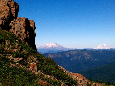
the right. Beautiful views of Mt. St. Helens and Mt. Rainier in the background
The arch! It looked like the rocks were glued together!
Kyle finishing one of the rocky portions of the trail


Ed's Trail eventually joins back up with the old Jeep road trail near the top (we took this way back down because it is easier and safer). The trail comes to a fork with an option of either continuing uphill to the north or south. The "official" summit is to the north with views of Mts. St. Helens, Rainier, and Jefferson, plus views of the trail we just hiked. The view to the south would have offered views of Mt. Hood and the Gorge, but unfortunately, it was still cloudy.

View of the spur from the summit!

Ed's Trail is visible on the left in the middle (between the 2
clumps of pine trees). The trail continues to the right of the
photo, onto and down the rocky areas

Kyle resting at the top with Mt. Adams on the horizon

We ate a snack at the top, took some pictures, and then headed back on the easier trail. On our way up, when we first spotted the actual summit of Silver Star, we both thought no way was that where we were headed! It seemed so far away and so much higher! So on our way back down I snapped a picture of the summit:

Silver Star Mountain summit at 4390'

Overall it was a great hike! We only gave it 4 stars in part due to the clouds we encountered to the south and the wind making for a tough hike. The views of the 3 mountains we saw were fantastic, but since Mt. Hood is my favorite mountain of all time (currently, who knows if I travel and get to see more!) I was bummed that I didn't get to see it.

Kyle taking pictures of the view, the old Jeep road trail to the left with us on Ed's Trail
Left: Mt. St. Helens (8365'--50 miles from Portland to the northeast)
Center left: Mt. Rainier (14411'--100 miles from Portland mostly to the north, and slightly east)
Right: Mt. Adams (12281'--105 miles from Portland mostly to the east, and then north)
(and this photo was slightly photoshopped to make the mountains easier to see)

Megan on a small rock outcropping offering optimal views of the three volcanoes!

There is another hike in our book that ends at the summit of Silver Star, but it takes a different spur to get to the top. The hike also passes by a couple of the other smaller mountains in the area and is a total of 13.5 miles. So hopefully, when we decide to tackle that hike, we go on a day when we can see Mt. Hood, Mt. Jefferson, and the Columbia River Gorge area better.

PS. Sorry for the poor photo quality. Again, we had to use our phones...lame! We are still working on buying a nice camera!