Showing posts with label waterfalls. Show all posts

Monday, June 6, 2011

Silver Falls State Park -#11

North Falls - One of ten gorgeous waterfalls
that can be viewed on Canyon Trail
When: 4/3/11
Time: 3hrs 45min
Distance: 7 miles
Difficulty: Moderately easy
Stars: 4

(Kyle posted Dog Mountain before we posted these other ones to show you all that, yes, we basically took off the entire month of May from hiking, but we are still going strong!)

Silver Falls State Park is known as the crown jewel of the state parks in the state of Oregon. There are 10 waterfalls that can be visited by a 7 mile hike. Also, to see the 2 main waterfalls, North and South Falls, there are parking areas by them both so if you want to just see the water you can park and check it out! Silver Falls State Park is so wonderful, one of the ten beautiful waterfalls was featured on the cover of the March issue of Sunset magazine! The Trail of Ten Falls is definitely worth making a visit too, especially on a sunny day like we had.

Kyle and I did this hike on a rare, free Sunday we had. Our frisbee team had a tournament that weekend, but neither of us could go since we both had to work on Saturday. Kyle also had to work on Sunday night, so we had to get out early. The park was about an hour and a half away, with us driving through some small Oregon towns.

The park's beauty speaks for itself! The trail starts off with a steep decline where you are immediately rewarded with a view of South Falls! You even get to walk behind it! From there on we continued walking along Silver Creek with a chance to view each of the 9 other waterfalls. I'll let the pictures do the talking!

South Falls - 177ft tall
In front of Lower South Falls - 93ft tall

Lower North Falls - 30ft tall

Took a short side trail to Double Falls - 178ft tall

Drake Falls - 27ft tall

Middle North Falls - 103ft tall
Another side trip to see Winter Falls - 134ft tall
Twin Falls - 31ft tall

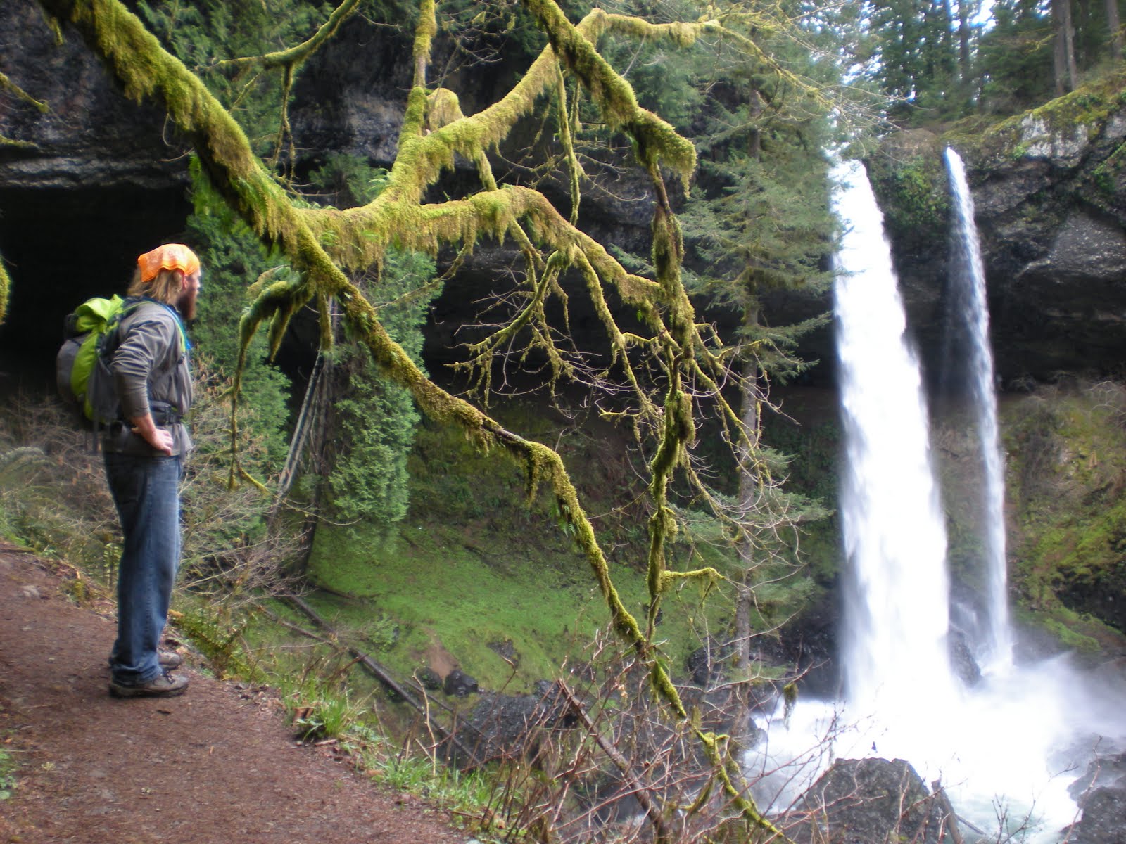
Kyle gazing at the beautiful North Falls - 136ft tall
Last, but not least, Upper North Falls - 65ft tall
All of the waterfalls were off Canyon Trail (aka Trail of Ten Falls) and then we took Rim Trail back to make the hike a nice, 7-mile loop. It was cool to see South Falls from above and then be able to walk behind it! The trail also goes behind North Falls and is actually pretty deep! Most of the waterfalls have cool little stories or unique things about them, so if you want to read more about that, make sure to check out the Silver Falls State Park's website! I want to go back when its warmer out because there is a great swimming area underneath Double Falls and places to splash around in front of Upper North Falls.
Kyle gazing out at the creek and waterfall from
underneath the cave made by North Falls

The hike back on Rim Trail was through the forest and was pretty uneventful. However, we did have this one last wonderful view of North Falls at a break in the trees:

Tuesday, May 31, 2011

Clackamas River Hike #10 (1/6 of the way done!)

Completed: 4/1/11
Time: 3.5 hours
Distance: 7.2 miles
Difficulty: Moderate
Stars: 3.5

In our book, the hikes are divided by region:
     In the Columbia River Gorge
     Around Mount St. Helens
     Up the Clackamas River
     Up the Santiam River
     Around Mount Hood
     The Coast and Coast Range
     In Portland and the Willamette Valley

So far, we have only done 2 regions: In the Columbia River Gorge and In Portland and the Willamette Valley. This is mostly due to hikes around Mt. St Helens and Mt. Hood don’t even open up until June or July, its super rainy on the coast in the spring (it will be better in the summer and fall), and the hikes up the rivers are pretty far away or not open until May. This hike, the Clackamas River hike, is one of the few that we were able to do that was within a reasonable distance.

Kyle really happy to be out hiking!

It was my turn to drive to the trailhead which was a bummer because the drive was even really pretty! I knew right away the hike was going to rock just because of the scenery while driving there. Our original plan was to hike the entire trail and back, which is a total of 15.6 miles and would have taken approximately 8 hours. Springtime is known for “big water” according to the author of our book because there is a lot of runoff from Mt. Hood/surrounding mountains, so all of the creeks are really high. Throughout the hike we had to cross a few creek/runoff areas, and at about halfway there was one creek, Pup Creek, that was just too deep to cross. So we ended up sitting down and eating lunch, and then turning heading back to our car. The author actually recommends turning around there anyways or parking a car at both trailheads so you don’t end up with such a long hike; Kyle and I just wanted a challenge!

Throughout the entire hike we were walking along the Clackamas River which was really cool; the river is good size with lots of rapids! There were times when we were at water level and then others when the trail climbed and we were along a steep cliff looking down at the water. The trail was similar to a roller coaster that it would keep going up and down, up and down with some parts definitely very steep. There were other parts of the trail where we were basically walking in sand, and at one of those times we detoured off the trail right up to the water’s edge.


Pup Creek Falls
Thankfully we were also out on a really nice day: low 60’s and not a cloud in the sky! There was also a side trail that we took to check out Pup Creek Falls, which is the waterfall that feeds into the same creek we were unable to cross! Throughout the hikes we have done so far, we have seen a lot of waterfalls, but they keep amazing me! One thing cool about Pup Creek Falls was that we got really close to the falls so there was a lot of moisture in the air and the trail was basically just mud. By the time we got back to the main trail we were both pretty wet which is why it is a good thing we always have our rain jackets!

This is a hike we definitely want to do again because the hike offers different things each season! In spring time there is “big water” and lots of flowers; summer it is a cool, shady place to beat the heat; in fall there are beautiful fall colors; not sure what exactly there is in winter, but the hike is open year-round so at least there is an option to hike this trail!
Mid-stream crossing! And the rocks are slippery!

Megan after crossing one stream

Where we sat down to eat lunch!

Flooded trail!


P.S. Kyle did not post this...Megan did! I just forgot to log Kyle out first! Oops!

Wednesday, April 6, 2011

#8~Wahkeena Falls to Multnomah Falls

at the base of Wahkeena Falls
Monica, Simone, Megan, and Kyle
Completed: 3/25/11
Rating: 3.5 stars
Difficulty: Moderate
Time: 3 hours
Length: 5.2 miles

In our hiking book, the author wrote that when he has friends visit this is the hike he takes them on first. So when my friend, Simone, came out to visit from Missouri this is where we went her first day! Our friend, Monica, also came along because it was her last day on SPRING BREAK! so she wanted to get a good hike in! We were very happy they joined us!

We parked our car at the Multnomah Falls lodge and viewing area and took the trail that follows the road (to keep people off the narrow highway) so we could make this hike a loop! We stopped at Wahkeena Falls to get some pictures before we started the steep switchbacks that are characteristic of Columbia Gorge hikes. There is a cool bridge that crosses over Wahkeena Falls and a nice look out point of the gorge before we started our hike along Wahkeena Spring.

view of the gorge!
The trail continued to climb, not nearly as steep as it did right in the beginning though and we also had the sounds and views of the spring to keep our mind off of the work we were putting in!


We took a short side trip to view where the spring begins to flow above ground which was pretty cool! The spring starts up on Mt. Hood but flows underground, so when looking at the river the trail walks by and on one side there's a creek and on the other, just woods! The hike then continued through the forest, and by this point you should all know how much kyle loves his tall trees!


The hike eventually started to slowly go back downhill, so we knew we needed to stop for a break soon. We rounded a bend in the trail and had a beautiful view of Mulnomah Creek. There was also a log that happened to be on the side of the trail, so we decided to stop for our break!

view of Multnomah Creek

Beers for our break!
So Multnomah Falls is a very famous waterfall that comes from Multnomah Creek. But the thing was that there were a ton of great waterfalls along the creek. So I took a few pictures, but I don't know any of the names! The creek was really pretty, the only thing dampening the hike was that it started to rain!


Waterfalls I love them!

Simone and Kyle on the trail along the creek
Kyle and I decided next time we hike this we
will cross the creek on this log and jump in!

Bridge!
So we eventually got to the part of the hike where it becomes paved and is very easily accessible by everyone. So the traffic on the trail picked up, but we still made our way down to the viewing platform to look out over Multnomah Falls. We then made our way down the many switchbacks until we got a great view of the falls! We finished up the hike and needed one last group picture! And the author of the book is right, this is a great hike for friends who are visiting!