Sunday, April 3, 2011

hike 7: part 1--hamilton mountain

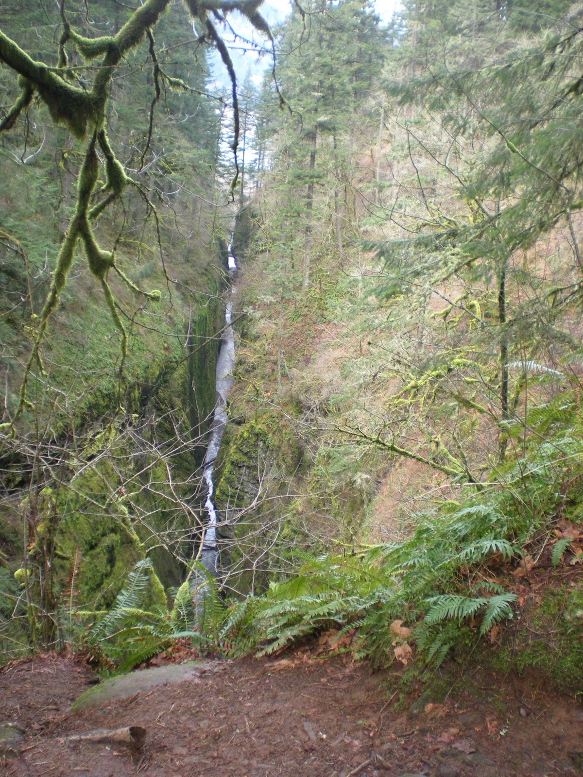
this peak was our destination!
completed: 3/22/11
difficulty: strenuous
rating: 4.5 stars
time: 4 hours and 45 minutes
length: 8 miles


kyle and i didn't have to work until 4:30, so we decided we would do a longer, more challenging hike.  we decided to do hamilton mountain because it isn't super far away and it was a pretty clear day so we wanted some good views! plus the book said it would only take about 3 and a half hours and so far we are usually faster than what is written! hamilton was our second hike in washington and the actual location isn't too much farther than multnomah falls. the biggest issue was the first bridge to cross over the columbia river was another 14 miles east of multnomah...it also happens to be the first bridge east of any of the bridges leading from portland to vancouver, wa. (kyle also forgot to mention that the bridge we crossed to get to our previous hike of coyote wall and the labyrinth was EXTREMELY narrow and had the ridges for water drainage so it was hard to steer and just super scary! i made him drive home because i didn't want to have to drive over it again! and for any of you family members who have crossed the mississippi river in louisiana, mo and how narrow that one is, this one was way worse and longer! i almost had a panic attack while driving!) so anyways, this tangent is getting way too long. we finally got a chance to cross a bridge we had only heard about from driving on i-84 but never seen: the bridge of the gods! fortunately it was way bigger than the previous bridge but unfortunately i wasn't as impressed especially since it had a name like "bridge of the gods".


so once we got to the trailhead we were impressed. the trail for hamilton mountain starts in beacon rock state park and this hike is described as 2 different hikes in the book; hamilton mountain and beacon rock (which is why this is part one!). we had to park at the trailhead for beacon rock, which is a very impressive work of nature (more on that later...) because the road to the campsite and the official trailhead of hamilton mountain is closed in the winter. so we actually did more than 8 miles, but not sure how much! 

the book describes hamilton mountain as strenuous, so we knew it was going to be a challenge going into it, and probably the most challenging hike we had done yet! i was a little nervous considering the walk up to the campsite was kinda steep! but the trail started right away in the forest and started to climb right away-not too steep, but definitely not easy! the elevation for the start of this is at approximately 500 ft, after the hike up from where we parked! so a little ways into the hike the forest clears into more of a meadow and it is because all of these power lines are up. that is where we had our first glimpse of the summit. we discussed for a few seconds if that could really be where we were going because it seemed far away! we also stopped at a bench there and shed some of our heavier layers!

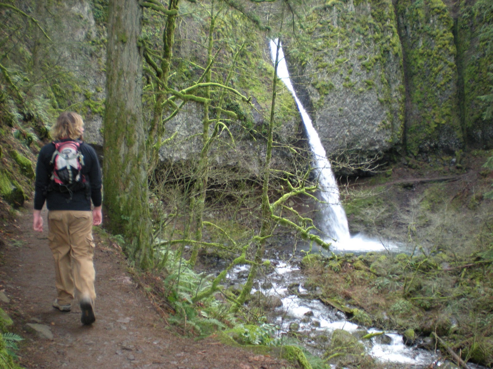
hardy falls
one of the many bridges we crossed!


back into the woods we went and crossed a couple of small streams that had bridges! we also got to check out 2 waterfalls from hardy creek on the hike. to get to view the first one, hardy falls, we had to descend down a very muddy and slippery trail. there was a nice viewing platform to get a look.

on the bridge close to the bottom of rodney falls
a picture of close to the top of rodney falls
and the railing is where the trail ends for
the "pool of winds"


the second waterfall, rodney falls, was really cool. the bridge that crossed the creek at this point was really close to the water and the falls were very rocky. there is also a small side trail that leads up to the "pool of winds" where you can get really sprayed from the waterfall. its called this because the water is basically exploding out of a bowl in the rock face! after crossing hardy creek, we had to climb some steps and the sun was peaking through the trees just right and the birds were chirping that it really felt peaceful. just a little bit farther we traveled on before we came to an intersection to choose the way up hamilton mountain: difficult or more difficult!


we went up the more difficult trail as was suggested in the book. i am glad we did because that way was definitely more interesting and the view was better because it overlooked the gorge almost the whole way! so the trail basically wound through the forest and was rather difficult. there were quite a few switchbacks and lots of places where if you fell of the side of the trail you would tumble down the hill pretty far! there was one point when we could look up and see a really rocky formation and we thought that was the top! we were wrong! we had a lot farther to go!

there were quite a few side trails at this point which we ended up taking and exploring quite a bit (one of the reasons why it took us so long to do!) we could also see trails up to this other peak, but thought there was no way that could be where we were going! we had already climbed so much and were up really high! plus it seemed really far away! again, we were wrong!
we thought we were at the top!

the actual summit of hamilton mountain in the background!

view of the gorge
so we decided to continue going because the book also said the trail was a loop and at the time the only way down would have been the way we came. at this point, the trail became even more steep (according to the book we climbed 700 feet in about a mile)! this part was definitely strenuous! kyle supposedly had a second wind and said he felt great! grr...i was cold and sweating at the same time and out of breath! not cool. 


but we knew when we reached the top! thank goodness there was a sign! and the reason i was cold was because there was still snow on top of the mountain! wonderful...not. so at the top we looked around (not much of a view of the gorge because the summit is on the north side and it was pretty cloudy by the time we got there so we couldn't see mt. adams or mt. st. helens) and ate our apples before finding the trail back down. another reason i was happy we took the trail up that we did was because there was a lot less snow. on our way down we walked through snow for about a half mile. not fun!

looking back at the other side of the summit 
as i mentioned, the trail down was a lot less cool. its an old road so its pretty wide, but just winds through the forest. so the main reason the hike took us so much longer than what the author said it would was because clumsy me happened to twist my ankle on the way back down! i did it a little bit before the trail split between difficult and more difficult. kyle was nice enough to not laugh at me (until later when i was laughing!) and helped me up. so the rest of the hike down was pretty slow, even though we were both afraid we were going to be late for work at this point! all in all a good hike that we will definitely visit again!

Thursday, March 31, 2011

6/60 Coyote Wall-The Labyrinth

Adventure is out there!
Completed: 3/9/11
Difficulty: Moderate
Rating: 4 stars
Time: 3 hours
Length: 5.2 miles


This was our first Washington hike! About 60 miles east to Hood River, OR, and then just across the Columbia River is Coyote Wall and the trail system known as The Labyrinth. It's a popular mountain bike location and the trail gets its name from the various off shoots and options you have when traveling from the top to the bottom.


We started our hike by following the ridge along Coyote Wall. The trail runs through a grassy field with lots of exposed rocks and boulders everywhere. It reminded me of what I always imagine Scotland look like.

Washington
Scotland


Climbing the ridge gave us a great vantage point over the Columbia river as well as the forested valley below. As we hiked the ridge it seemed to wind on forever. Switchbacks were built into the trail to make the ascent easier for foot and wheeled transportation alike, and every time we were back on the ridge there seemed to be more ground added as we looked ahead. It made the trail seem daunting at times, but we continued to put our best foot forward.


We encountered a few bikers as we were out, and I started imagining what each turn and rock drop would be like from behind the saddle. Megan will attest that "this would be fun on a bike" has been a comment uttered from my lips frequently on our hikes, but it was even worse as bikers descended around us on their full-suspension machines. Half of my hike was spent mapping out how I was going to work my mountain bike back into a more solid riding condition.


catching sweet air would be extra rad with this scene
of the Columbia River in the background

The ridge continued on and we continued on following it. It eventually turned as we neared the top so that we were moving parallel to river. This lent itself to an excellent view of the river with the valley below. The trail had a descent from the top that dove down into the valley. It looked steep and it looked like it would be fun on a mountain bike, but we turned on our heals and headed back down the way we came so that we could enter, and explore, the labyrinth.

We stuck to a trail that led us on the outside of the labyrinth and let us see a good amount of the surrounding area. The trail ducked in and out of big boulders, shot over a creek, ran down the hillside, and nestled right along a bunch of mini waterfalls formed by a combination of the rocks and hillside (this was Megan's favorite part).


The labyrinth is a destination we will be returning to. Hopefully I will be back with a couple of wheels to accompany me, but I know we will come back to hike because during the summer the field is FILLED with wild flowers. While they weren't in full bloom, it is always a treat to see some color like this in March!


Saturday, March 5, 2011

valentine's day

heart-shaped pancake with goat cheese for valentine's day
so kyle and i haven't been hiking since 2/11 because that next week i worked too much, the week after that it was only about 25 degrees out, and now it has been raining! we are working on being outfitted for the rain, but not 100% there yet. we are planning our next hike for wednesday, march 9th. i did some math, and if we are planning on getting all of these hikes done we should already have in 10 hikes. but once it gets nicer out we figure we will be hiking at least 2 times a week, so we should be fine! also, ultimate frisbee practice starts tomorrow morning with our team rowboat! and our first tournament is schedule the first weekend in april (i think!).

since there are no hikes to post about, i figured i would share what kyle and i did for valentine's day! due to the fact that we both work in the service industry, of course we were working the night of valentine's day on that monday. we both also worked the previous sunday night, and i had to work the saturday night before hand. so we planned to celebrate on thursday, february 17th!

kyle's name written in pancake!
we did have some fun for 14th though. we were originally planning on going hiking, but the weather just really was not great. so instead we woke up and kyle had a couple of nice gifts waiting for me! then we went out to breakfast at slappy cakes; a breakfast place where lots of tables have a griddle in the middle of them and you get to make your own pancakes! we started with some breakfast beverages-kyle had a bloody mary with bacon and i had a pomegranate mimosa! kyle and i chose to have peanut butter batter and the vegan pancake batter (i wanted to try it to see if it would be any good!) and our mix-ins were bananas, chocolate chips, sausage, and goat cheese. there were 4 other batters to choose from and about 15 other mix-ins. my favorite combo was the peanut butter batter with bananas in it! but the combo of vegan batter, sausage, and goat cheese was also delicious! then after breakfast we of course went rock climbing at one of our favorite places-circuit!

drinks at slappy cakes!
so then on thursday night we got dressed up all cute (i wore a dressy!) and went to get wine and dessert! we decided to check out pix which is known for there wonderful desserts and extensive wine menu! they also have certain beers that pair well with desserts and liqueurs. we ordered 2 desserts to share and had a bottle of wine. kyle was sweet enough to let me choose the wine, and of course i chose my favorite kind-moscato d'asti! it is a dessert wine so we figured the sweetness would pair well with the richness of the desserts!


shazam in the background and amelie up front! yum!
the desserts we had were called "shazam!" (description from pix's website: rich and creamy caramel mousse, salted almonds, dense chocolate almond cake, and more caramel) and "amelie" (orange vanilla crème brûlée sits atop a glazed chocolate mousse with caramelized hazelnuts, praline crisp, and Cointreau génoise). the dessert options available are displayed in a case in the front of the restaurant. so there are many other i would like to try sometime! our wine was from bigaro, a blush, italian wine, and i loved it! we then went home and watched a couple of episodes of the simpsons before calling it a night.


i hope everyone's valentine's day was great! and yes i'm a sucker for this hallmark holiday.

Wednesday, March 2, 2011

TRIPLE FALLS - hike #5

looking out at oneota creek from the bridge
completed: 2/11/11
difficulty: moderately difficult
rating: 4 stars
time: 2 hours
length: 4.5 miles (out and back)

so far, this has been one of my favorite hikes. yes, there are a TON of waterfalls around the columbia river gorge and the portland area in general, but i can't get enough of them. i know kyle prefers the hikes with big-time views, so he liked it, but not as much as me! so just a warning...i took a lot of pictures!

the picture to the right is from the very end of the hike (the trail didn't end, we just decided to turn around! most of the trails in the columbia river gorge area all connect and this one happens to go all the way to larch mountain-a hike we will eventually do once the snow has melted and the trail opens again!). the creek is called the oneonta and is responsible for 4 waterfalls we see on this hike: horsetail falls, ponytail falls, oneota falls, and triple falls.

the hike starts at the parking lot for the popular horsetail falls. you can see horsetail falls right off the historical scenic highway on your way to multnomah falls. the falls pops right out and there is a little brick viewing area of it too. if horsetail falls sounds familiar, its because it has been mentioned a few times (either on here or on facebook, or you may have visisted it with us!). during our move to portland, we took a detour so we could see multnomah falls but we first stopped at horsetail falls with my parents (check out that post here). we took some pictures and even got the cat out for a few pictures here. then while kyle's family was visiting in january we also stopped here. during those first 2 visits i had no idea there was a trailhead there too.or  maybe i did see the sign and trail and just didn't realize what it was, who knows!

kyle and i in august!
january...


                                                                     february...before the hike!

so the hike started off with quite a bit of an incline...but once we reached the top of that area it leveled off for a little bit. we got to hike through the forest and it was mostly shaded. not too long after we came to upper horsetail falls, also known as ponytail falls, and that area was EXTREMELY cool. the falls basically shoots out of this basalt rock and the trail goes BEHIND the waterfall! here are a bunch of pictures:

approaching the falls...

closer look at the trail...you can see it really well on the right!

kyle wanting to climb, surprise, surprise...

a look at the trail from underneath the rock!
it was nice and dry underneath this area, but once
we approached the other side it was really wet
and windy!

looking out at the falls from under the rock (the
visible trail is where we were headed...)

i like this picture!
(the visible trails is where we just came from!)

looking back at ponytail falls before we
continued on!


so after ponytail falls we walked through the forest some more. we were up kind of high at this point, so if we walked towards the north (there were a bunch of hiker-made trails here) we could see some cool views of the columbia river gorge. nothing like we did while hiking angel's rest though. but still cool. we checked this out more on our way back.

so about a mile past ponytail falls the trail descends quite steeply. lots of switchbacks that were quite narrow too. at one point while turning to go to the next switchback i had to call kyle back to come look at a cool view; the oneota gorge. a canyon area created by oneota creek but very obviously cut into the rock. 


the view is from up high semi-looking down
into the gorge. i kind of think this looks like
a waterfall. but trust me, it isn't.


so after descending we crossed a cool little bridge and got a look at oneota falls. not that great and really no great pictures of it. after the bridge though, it was basically looking straight up at what we had to climb next! to get to triple falls we had to climb back up the other side of the gorge and of course follow a bunch of switchbacks. it was quite rocky in some places and there were even places where we were basically hiking along a cliff. we could tell we were getting close to triple falls because we could hear lots of water, but we were still pretty high when looking down at the creek. 

we eventually turned a corner and had a gorgeous view of the falls. this picture was taken at a viewing area that happened to be naturally cut into the trail. we just had to descend a little rocky area to get to it off the trail. this is the best view of the falls because the actual trail doesn't have that great of a view because of trees being in the way. jutting out on the falls there is a giant log that kyle and i both walked across so we could get a spectacular view close up! it was only a little scary! thank goodness for my new hiking shoes! and in the background you can see a bridge and that is where we stopped, took a few pictures, and then turned around. the hike back was just as cool! we both thought this would be a good hike to take friends and family on if they ever want to venture out with us. yes it is difficult in areas, but very typical to the hiking around. plus the scenery is wonderful! and here are some more pictures to enjoy! if only we had a better camera...


Wednesday, February 23, 2011

4/60 Angel's Rest

Completed: 2/4/11
Difficulty: Difficult (steep)
Rating: 5 stars
Time: 1 hour 45 minutes
Length: 4.6 miles


It was a cool 40 degrees out that morning, but the sun was shining and we were excited to get out on the trail! We checked a forecast quickly, saw a report for some rain (60% chance), but were too excited about the current sunshine to pay much attention to it. The book described Angel's Rest as having a great view of the river and gorge on a clear day, so we packed a lunch for ourselves to enjoy the view from the top. Anxious to get out, we hit the road for the Columbia River Gorge.


The hike starts steep. A lung burner, and sad reminder of how much work we need to do before the ultimate season begins (this is a start, of course!). It winds past a waterfall early on (a big theme in the Columbia River Gorge area), that had a cool view of it near a tree with a big hole in it. It seemed possible to fit through the tree, but then again there wasn't much on the other side other than a little cliff, so no attempt was made.
Probably could have fit
Coopey Falls


The trail winds itself up, with numerous switch backs that alternated between giving us great views to the east of the gorge and great views to the west of the gorge. We continued up, eventually finding the source to Coopey Falls, and conquering it!


Treacherous!


The hike mellowed out through the middle, then finishes steep again and features a rock scramble near the top. A debate ensued as we were nearing as to what exactly classifies a "rock scramble". I was envisioning big boulders that you must use all four limbs to traverse safely. We were also constantly questioning every large rock on the trail as to whether that was considered the "scramble", concerned about our next direction. We finally rounded a corner and the trail disappeared, replaced instead by a small field of rocks, some in very precarious positions. We both had a "ohhhhhh, this is the rock scramble" moment, and finally felt confident in our next direction.

The top was not far from the scramble, and though some clouds had started to set in a little, the view of the river was still great. The top was fun as well, with lot's of big rocks to "play" around on and explore.
Columbia River

We were just about to settle into a spot to enjoy our lunch at when the exposed rocks we were on got wet, and windy, and cold. In a short instant, that 60% chance of rain that we glossed over earlier in the day became all too much of a reality to us. We quickly decided to postpone our lunch plans until we could seek shelter, and with just one piece of rain equipment between the two of us, realized we may have been just slightly unprepared for the weather. We made it back down the trail in double time, reaching the car damp and cold, but still smiling. Our overall trail time was almost a full hour less than what our book predicted it would be, so if there was a positive to come out of this it is that we were efficient.

The fact that our leisurely lunch plans were "washed" away that afternoon didn't upset us too much because this hike has a 3 mile "extension" route that will take us up to Devil's Rest. So, we already have plans to revisit this trail some time down the road, and take the advanced route. We will be sure to 1) Bring another lunch to make up for this hike and 2) bring better rain gear.

Me out on the point. Already looking a little cold...

Friday, February 11, 2011

3/60 marquam trail to council crest & kyle's birthday!

Completed: 2/2/11 (Kyle's birthday!)
Difficulty: Moderate
Rating: 3.5 stars
Time: we forgot to look! and we got a little lost!
Length: 3.7 miles

this picture is a view from the top of our hike! (the photo isn't the best and didn't do all of the views justice because i, unfortunately, do not have a great camera! also, if you are thinking of buying kyle and i a gift anytime soon, a fancy camera is very high on our 'want' list!)

so one of the things kyle wanted to do on his birthday was go hiking! so the plan was to wake up semi-early and go hiking, then go for lunch, hang out and watch a movie at home, go climbing, and then eat cake!
so we decided to do the marquam trail to council crest hike because it is in town (about 5 minutes from downtown!) and the author of our hiking book recommends doing this on a clear day because you have a view of mt. st. helens, mt. rainier, mt. hood, and mt. adams--which all happen to be volcanoes! and i know how much kyle loves mt. hood, so i suggested this one!

the trail starts out near ohsu (which happens to be one of the hospitals i want a job at!) so i knew exactly how to get there. marquam trail happens to be a little nature preserve-type area that has a nice loop and that connects to the council crest trail! the trail crossed 2 different roads and cut through the woods near some awesome houses, so you could tell it was right in town. it did also cross over the road that leads up to council crest park. it is good to know that there is a road because all though i really enjoyed this hike it would be

nice to take friends and family who are visiting up there and there isn't always enough time for everything!

this hike was DEFINITELY worth it because the views on top were A.M.A.Z.I.N.G! this was also a pretty busy trail and i can only imagine hiking it everyday as a nice start to the day kinda thing! there were some pretty parts to the forest area that we were walking through including a fallen-log bridge (and a real bridge that i crossed...kyle took the dangerous route!) and a stream.

kyle and i also happened to get a little turned around. at one point there was an option of taking the higher path or the lower path. we chose the higher path. well eventually this took us way to far to the left (council crest was to the right of where we started) so i thought it felt wrong. we finally happened upon another hiker so i asked if we were going the right way. NOPE! so we turned around! we did walk about 3/4 miles out of our way though! just a little extra exercise!

we took our time up at the top and took lots of pictures! sadly, most didn't turn out that great! once we got back down to our car we drove downtown and went to deschutes for lunch. it is a little expensive but kyle and i really like it! so far we have taken my mom, ryne and sam, and kyle's family all there! the place has good food and great beer! plus we filled up kyle's growler! we stopped at belmont station so kyle could buy himself an expensive bottle of beer with some of his birthday money and one of his co-workers suggested we check out rocky butte if we were looking for views of mt. hood! thats another place in portland (this time you drive to it!) and it was really cool! more great views!

later we got home and watched groundhog day which was a very fitting choice and i had never seen it! then we went climbing and came home and ate chocolate chip cookie dough ice cream cake from cold stone! cold stone ice cream cakes are one of kyle's favorites!

so right now if we are to get all of these hikes done by the end of the year we should already be at 7! eek! we have 4 done (we are a little behind on the blogging!) and we are doing another tomorrow! we are still playing catch up!

and i finally got new hiking shoes! i LOVE them!


Thursday, February 10, 2011

2/60 - Oaks Bottom Wildlife Refuge 1/25/11


Nom nom nom nom nom nom
3 miles
1 hour
Easy
Two Stars


Fish...Duck..Frog...Duck...Fish...Duck......Pacman!

The Oaks Bottom Wildlife Refuge is a nature and wildlife preserve located within the city. The concrete trail leading down to the lake is painted with duck's and fish's and frog's, all being eaten by Pacman! There is a big lake that attracts ducks, geese, beavers, heron's and other's. The bird watching is great (though not quite the season when we went out). They have a tadpole pond that is used as a study site and attracts many classes to the park. In fact, a class was leaving as we arrived.


Nature! In building form!
The lake and trail are in the middle of an urban setting, but the area is doing it's best to fit in with it's natural surroundings. The building imitates the scene from the surrounding area.

The hike was nice. The area is great. It would be the ideal place to walk your dog, especially if you were close by. The birds would give us a reason to come back, but not much else.  All in all it was a nice little way to spend an hour!