Thursday, March 31, 2011

6/60 Coyote Wall-The Labyrinth

Adventure is out there!
Completed: 3/9/11
Difficulty: Moderate
Rating: 4 stars
Time: 3 hours
Length: 5.2 miles


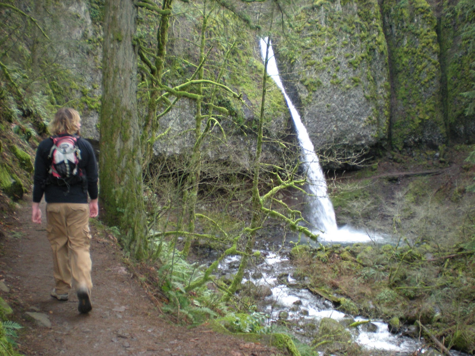
This was our first Washington hike! About 60 miles east to Hood River, OR, and then just across the Columbia River is Coyote Wall and the trail system known as The Labyrinth. It's a popular mountain bike location and the trail gets its name from the various off shoots and options you have when traveling from the top to the bottom.


We started our hike by following the ridge along Coyote Wall. The trail runs through a grassy field with lots of exposed rocks and boulders everywhere. It reminded me of what I always imagine Scotland look like.

Washington
Scotland


Climbing the ridge gave us a great vantage point over the Columbia river as well as the forested valley below. As we hiked the ridge it seemed to wind on forever. Switchbacks were built into the trail to make the ascent easier for foot and wheeled transportation alike, and every time we were back on the ridge there seemed to be more ground added as we looked ahead. It made the trail seem daunting at times, but we continued to put our best foot forward.


We encountered a few bikers as we were out, and I started imagining what each turn and rock drop would be like from behind the saddle. Megan will attest that "this would be fun on a bike" has been a comment uttered from my lips frequently on our hikes, but it was even worse as bikers descended around us on their full-suspension machines. Half of my hike was spent mapping out how I was going to work my mountain bike back into a more solid riding condition.


catching sweet air would be extra rad with this scene
of the Columbia River in the background

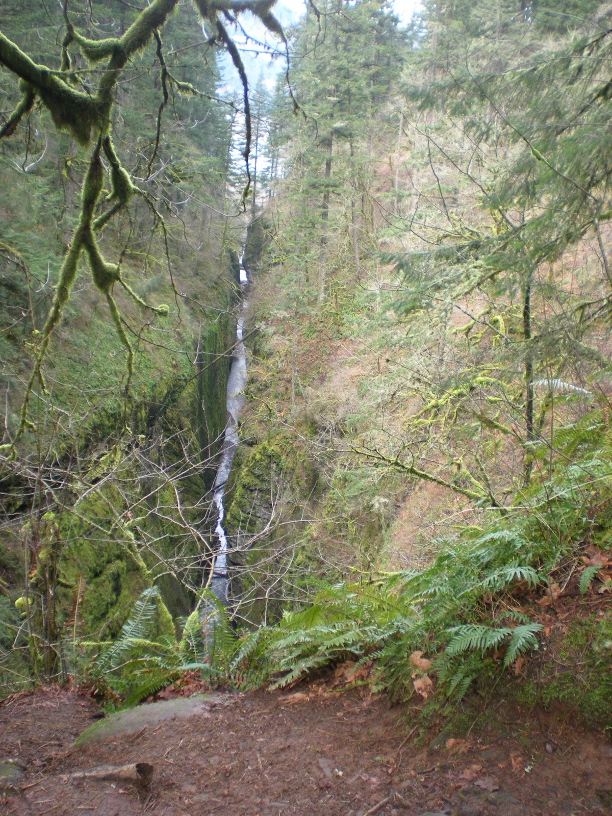
The ridge continued on and we continued on following it. It eventually turned as we neared the top so that we were moving parallel to river. This lent itself to an excellent view of the river with the valley below. The trail had a descent from the top that dove down into the valley. It looked steep and it looked like it would be fun on a mountain bike, but we turned on our heals and headed back down the way we came so that we could enter, and explore, the labyrinth.

We stuck to a trail that led us on the outside of the labyrinth and let us see a good amount of the surrounding area. The trail ducked in and out of big boulders, shot over a creek, ran down the hillside, and nestled right along a bunch of mini waterfalls formed by a combination of the rocks and hillside (this was Megan's favorite part).


The labyrinth is a destination we will be returning to. Hopefully I will be back with a couple of wheels to accompany me, but I know we will come back to hike because during the summer the field is FILLED with wild flowers. While they weren't in full bloom, it is always a treat to see some color like this in March!


Saturday, March 5, 2011

valentine's day

heart-shaped pancake with goat cheese for valentine's day
so kyle and i haven't been hiking since 2/11 because that next week i worked too much, the week after that it was only about 25 degrees out, and now it has been raining! we are working on being outfitted for the rain, but not 100% there yet. we are planning our next hike for wednesday, march 9th. i did some math, and if we are planning on getting all of these hikes done we should already have in 10 hikes. but once it gets nicer out we figure we will be hiking at least 2 times a week, so we should be fine! also, ultimate frisbee practice starts tomorrow morning with our team rowboat! and our first tournament is schedule the first weekend in april (i think!).

since there are no hikes to post about, i figured i would share what kyle and i did for valentine's day! due to the fact that we both work in the service industry, of course we were working the night of valentine's day on that monday. we both also worked the previous sunday night, and i had to work the saturday night before hand. so we planned to celebrate on thursday, february 17th!

kyle's name written in pancake!
we did have some fun for 14th though. we were originally planning on going hiking, but the weather just really was not great. so instead we woke up and kyle had a couple of nice gifts waiting for me! then we went out to breakfast at slappy cakes; a breakfast place where lots of tables have a griddle in the middle of them and you get to make your own pancakes! we started with some breakfast beverages-kyle had a bloody mary with bacon and i had a pomegranate mimosa! kyle and i chose to have peanut butter batter and the vegan pancake batter (i wanted to try it to see if it would be any good!) and our mix-ins were bananas, chocolate chips, sausage, and goat cheese. there were 4 other batters to choose from and about 15 other mix-ins. my favorite combo was the peanut butter batter with bananas in it! but the combo of vegan batter, sausage, and goat cheese was also delicious! then after breakfast we of course went rock climbing at one of our favorite places-circuit!

drinks at slappy cakes!
so then on thursday night we got dressed up all cute (i wore a dressy!) and went to get wine and dessert! we decided to check out pix which is known for there wonderful desserts and extensive wine menu! they also have certain beers that pair well with desserts and liqueurs. we ordered 2 desserts to share and had a bottle of wine. kyle was sweet enough to let me choose the wine, and of course i chose my favorite kind-moscato d'asti! it is a dessert wine so we figured the sweetness would pair well with the richness of the desserts!


shazam in the background and amelie up front! yum!
the desserts we had were called "shazam!" (description from pix's website: rich and creamy caramel mousse, salted almonds, dense chocolate almond cake, and more caramel) and "amelie" (orange vanilla crème brûlée sits atop a glazed chocolate mousse with caramelized hazelnuts, praline crisp, and Cointreau génoise). the dessert options available are displayed in a case in the front of the restaurant. so there are many other i would like to try sometime! our wine was from bigaro, a blush, italian wine, and i loved it! we then went home and watched a couple of episodes of the simpsons before calling it a night.


i hope everyone's valentine's day was great! and yes i'm a sucker for this hallmark holiday.

Wednesday, March 2, 2011

TRIPLE FALLS - hike #5

looking out at oneota creek from the bridge
completed: 2/11/11
difficulty: moderately difficult
rating: 4 stars
time: 2 hours
length: 4.5 miles (out and back)

so far, this has been one of my favorite hikes. yes, there are a TON of waterfalls around the columbia river gorge and the portland area in general, but i can't get enough of them. i know kyle prefers the hikes with big-time views, so he liked it, but not as much as me! so just a warning...i took a lot of pictures!

the picture to the right is from the very end of the hike (the trail didn't end, we just decided to turn around! most of the trails in the columbia river gorge area all connect and this one happens to go all the way to larch mountain-a hike we will eventually do once the snow has melted and the trail opens again!). the creek is called the oneonta and is responsible for 4 waterfalls we see on this hike: horsetail falls, ponytail falls, oneota falls, and triple falls.

the hike starts at the parking lot for the popular horsetail falls. you can see horsetail falls right off the historical scenic highway on your way to multnomah falls. the falls pops right out and there is a little brick viewing area of it too. if horsetail falls sounds familiar, its because it has been mentioned a few times (either on here or on facebook, or you may have visisted it with us!). during our move to portland, we took a detour so we could see multnomah falls but we first stopped at horsetail falls with my parents (check out that post here). we took some pictures and even got the cat out for a few pictures here. then while kyle's family was visiting in january we also stopped here. during those first 2 visits i had no idea there was a trailhead there too.or  maybe i did see the sign and trail and just didn't realize what it was, who knows!

kyle and i in august!
january...


                                                                     february...before the hike!

so the hike started off with quite a bit of an incline...but once we reached the top of that area it leveled off for a little bit. we got to hike through the forest and it was mostly shaded. not too long after we came to upper horsetail falls, also known as ponytail falls, and that area was EXTREMELY cool. the falls basically shoots out of this basalt rock and the trail goes BEHIND the waterfall! here are a bunch of pictures:

approaching the falls...

closer look at the trail...you can see it really well on the right!

kyle wanting to climb, surprise, surprise...

a look at the trail from underneath the rock!
it was nice and dry underneath this area, but once
we approached the other side it was really wet
and windy!

looking out at the falls from under the rock (the
visible trail is where we were headed...)

i like this picture!
(the visible trails is where we just came from!)

looking back at ponytail falls before we
continued on!


so after ponytail falls we walked through the forest some more. we were up kind of high at this point, so if we walked towards the north (there were a bunch of hiker-made trails here) we could see some cool views of the columbia river gorge. nothing like we did while hiking angel's rest though. but still cool. we checked this out more on our way back.

so about a mile past ponytail falls the trail descends quite steeply. lots of switchbacks that were quite narrow too. at one point while turning to go to the next switchback i had to call kyle back to come look at a cool view; the oneota gorge. a canyon area created by oneota creek but very obviously cut into the rock. 


the view is from up high semi-looking down
into the gorge. i kind of think this looks like
a waterfall. but trust me, it isn't.


so after descending we crossed a cool little bridge and got a look at oneota falls. not that great and really no great pictures of it. after the bridge though, it was basically looking straight up at what we had to climb next! to get to triple falls we had to climb back up the other side of the gorge and of course follow a bunch of switchbacks. it was quite rocky in some places and there were even places where we were basically hiking along a cliff. we could tell we were getting close to triple falls because we could hear lots of water, but we were still pretty high when looking down at the creek. 

we eventually turned a corner and had a gorgeous view of the falls. this picture was taken at a viewing area that happened to be naturally cut into the trail. we just had to descend a little rocky area to get to it off the trail. this is the best view of the falls because the actual trail doesn't have that great of a view because of trees being in the way. jutting out on the falls there is a giant log that kyle and i both walked across so we could get a spectacular view close up! it was only a little scary! thank goodness for my new hiking shoes! and in the background you can see a bridge and that is where we stopped, took a few pictures, and then turned around. the hike back was just as cool! we both thought this would be a good hike to take friends and family on if they ever want to venture out with us. yes it is difficult in areas, but very typical to the hiking around. plus the scenery is wonderful! and here are some more pictures to enjoy! if only we had a better camera...